Hills and climbs: how height changes walking minutes
How an uphill walk changes walking time and the score. A look at 12 Rustaveli Avenue in Tbilisi: average gradient 6.4%, 9.6 minutes on climbs.
Score your own address
Everything this article covers, you can check on your own address: free, in a minute.
Free. The score at once, the full report after an e-mail sign-in.
Contents 6 sections
Seven hundred metres uphill are not seven hundred metres
On a map, two schools 674 and 693 metres from home look equally close. But if the first one means climbing 50 metres and the second only 21, you will walk to the second, even though it is further. In a hilly city metres say almost nothing about the walk.
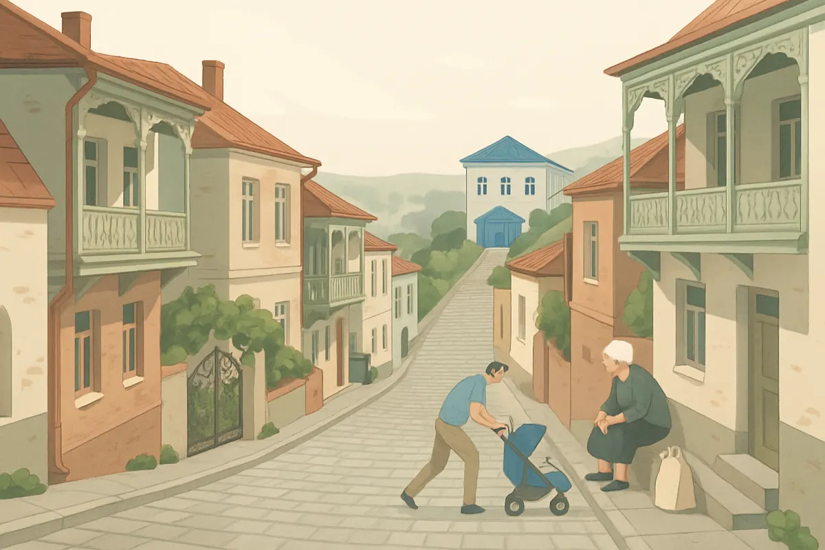
That is why the score turns climbing into minutes. Below we look at how this works and what the terrain costs, using 12 Shota Rustaveli Avenue in Tbilisi, report of 4 October 2026.
How a climb turns into minutes
For every stretch of a route we take the height at its start and its end and work out the gradient. The steeper the stretch, the slower people walk it. Stretches with a gradient under 3% count as flat: legs hardly notice such a difference, and the elevation model is not accurate at that scale anyway.
Uphill and downhill are counted together, as the average of the way there and back. A downhill walk to the shop means an uphill walk home with the bags, so a place below the building does not beat a place above it.
- For an ordinary pedestrian a street with a 10% gradient costs 21% more than a flat one, and a 20% street 72% more.
- For a family with a child the same 10% street costs a third more: a pram goes uphill more slowly.
- For an older person it costs 41% more, and a 20% street costs 2.6 times as much as a flat one.
Stairs are counted separately. For an ordinary pedestrian a flight costs one and a half times as much as a flat path of the same length; for a family with a pram and for an older person, three times as much.
Rustaveli 12: the terrain in numbers
The building stands 434 metres above sea level. The average gradient of the streets around it is 6.4%, the steepest 10.6%. The map shows 3196 metres of stairs in the area. For comparison: that is more than three kilometres of steps you will have to get round with a pram or a suitcase.
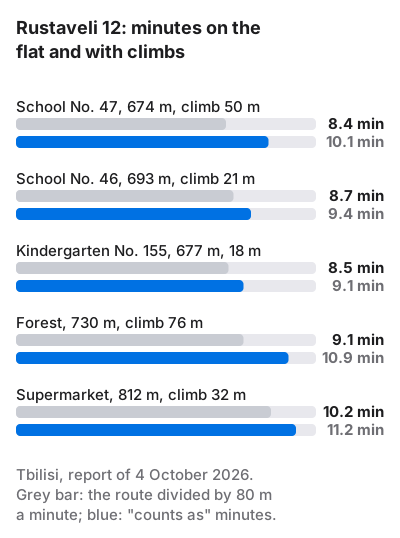
Let us see what the climbs cost particular places. Minutes on the flat are the length of the route divided by an ordinary pace, 80 metres a minute. "Counts as" minutes are what the report calculated.
| Place | Route | Climb | On the flat | Counts as |
|---|---|---|---|---|
| School No. 47 | 674 m | 50 m | 8.4 min | 10.1 min |
| School No. 46 | 693 m | 21 m | 8.7 min | 9.4 min |
| Kindergarten No. 155 | 677 m | 18 m | 8.5 min | 9.1 min |
| Patch of forest | 730 m | 76 m | 9.1 min | 10.9 min |
| Carrefour supermarket | 812 m | 32 m | 10.2 min | 11.2 min |
School No. 47 is 19 metres closer than School No. 46, yet counts as 0.7 minutes further. The School need takes the two best places: first place went to the classical gymnasium 155 metres away, second to School No. 46, and No. 47 came third and did not enter the calculation.
These are the minutes of an ordinary pedestrian. With a child the walk is longer for two reasons. The pace is slower, 65 metres a minute, so the 674 metres to School No. 47 take 10.4 minutes even on the flat. And a 50-metre climb costs a family more than it costs an adult without a pram. An older person walks 60 metres a minute, so for them the same school is 11.2 minutes on the flat, before any climbing. That is why in a hilly district the profile in the report matters more than in a flat one: the gap between profiles grows with every metre of height.
What the terrain costs in the score
Climbs hit the score in two ways. The first shows in every row: a place further away in minutes keeps less of its value. But as long as the minutes stay within five, nothing is lost, and five to nine minutes are still close to full value for most needs.
The second way is the Street network category. One of its parts shows what share of the time on the routes to everyday places is ordinary walking on the flat. At Rustaveli 12 it is 93.6%. The rest goes on climbs, 9.6 minutes, and on waiting at crossings, 0.5 minutes. This part scored 78.7 out of 100.
Let us work out the cost. The part weighs 40% of the category, and the category 14 points of the score. A shortfall of 21.3 out of 100 gives 21.3 × 0.4 × 0.14 = 1.2 points, almost all of it from the terrain. The address's final score is 90.4: the climbs did not spoil it much, because almost everything needed here is within five or six minutes.
Where the elevation model gets it wrong
We take heights from an open terrain model, and it has a weakness: it smooths out short, steep streets. A twenty-metre climb on a short lane may be smeared across the neighbouring blocks. So in old districts on a slope the real walk can be harder than the report says.
The opposite happens too. If there is a staircase between the building and the shop that is missing from the map, the report will send you round by a winding road and count more minutes than you will actually spend.
How to choose an address in a hilly city
- Run the report with your own profile. With a pram or for elderly parents climbs cost one and a half to two times as much as for an ordinary pedestrian.
- Look at the climb column for the places you will go to every day: the shop, the school, the stop.
- Check the stairs. If the report shows several kilometres of them and you have a pram, walk the main routes yourself.
- Remember the way back: a shop downhill means an uphill walk with your shopping.
How a climb enters the minutes and how the minutes turn into the value of a place is described on the page How it is calculated. Tbilisi district by district is on the Tbilisi page, and addresses across Georgia are in the rating for Georgia.
Questions
How does an uphill climb affect walking time?
By our formula a street with a 10% gradient costs an ordinary pedestrian 21% more than a flat one, a family with a child a third more, an older person 41% more.
Is the downhill counted?
Yes, uphill and downhill are counted as the average of the way there and back: a place below the building means a climb on the way home.
Why does the report show less climbing than there really is?
The elevation model smooths out short, steep streets. On slopes with old buildings, check the main routes on foot.