How to check a neighbourhood with a pram: steps and kerbs
A neighbourhood with a pram: stairs, kerbs and climbs on the way to nursery and playground. How the report shows it, using 12 Rustaveli Avenue in Tbilisi.
Score your own address
Everything this article covers, you can check on your own address: free, in a minute.
Free. The score at once, the full report after an e-mail sign-in.
Contents 7 sections
Why a pram is more honest than a map
An adult with nothing to carry barely notices how a street is built. A step at the entrance, a high kerb, an underpass, a steep two-block climb: each costs a couple of seconds. With a pram every such detail becomes an obstacle, and a route that looks short on the map turns into a detour.
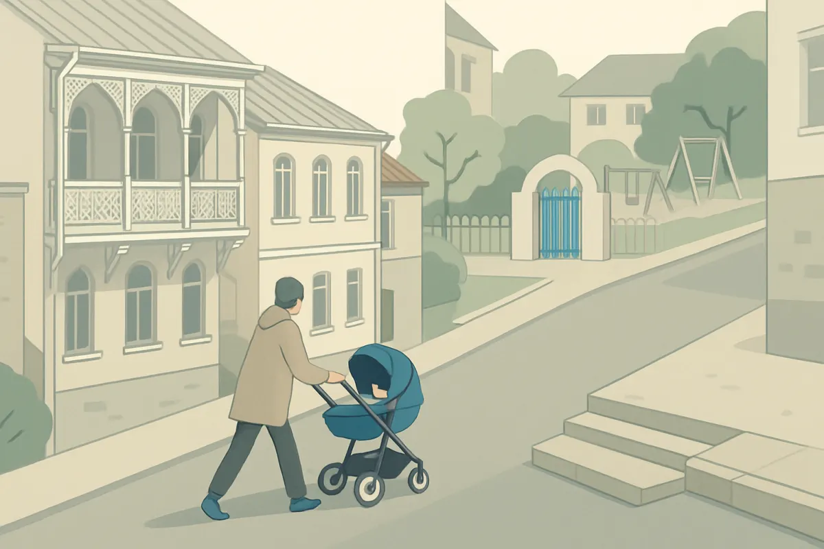
That is why a pram is a good test of a neighbourhood. If you can push one to the shop, the nursery, the playground and the park, then older parents, someone with a suitcase and you yourself after a hard day can get there too.
We picked a deliberately hard example: 12 Rustaveli Avenue in central Tbilisi, report of 4 October 2026. Score 90.4, band "Everything on foot". For an adult it is one of the best addresses in Georgia. Let us look at it through the eyes of a parent with a pram.
Steps: 3196 metres of stairs
In the block "What can get in the way" the report counts stairs on the walking paths around the building. Around 12 Rustaveli Avenue there are 3196 metres of them. The note on that line says it plainly: with a pram, a suitcase or a bike you will have to look for a way round.
In the General profile a staircase counts as one and a half times its length. In the Family with a child profile, three times. If the short way to a playground goes over steps, with the family profile it may come out longer than the detour, and the report's route will take the detour.
Kerbs: 17 crossings out of 233
In the walking area around the building the map knows 233 pedestrian crossings. Of these, 17 are marked with a dropped kerb and 6 with tactile paving. That does not mean the rest are impassable: kerb data in the open map is incomplete, and a missing tag says nothing. But 17 out of 233 means you will have to check for yourself.
Building entrances look similar. The map marks 50 places as step-free, 45 as partly accessible and 375 as having steps. Only about a tenth of the places around carry such tags, so this is a pointer, not a census.
Pavements and major roads
Two more lines from the same report. 58.8% of the street network around the building is fit for walking: the rest is carriageway with little room for pedestrians. And there are 8.52 kilometres of major roads in the walking area. They can be crossed only where there is a crossing, and not every crossing suits a pram.
On the map this looks like a grid of streets. In reality the grid is sparser for a pram: some stretches have no proper pavement, some crossings have steps or a high kerb. Hence the advice to walk the main route yourself.
Climbs: 6.4% on average
Tbilisi is built on slopes, and the centre is no exception. The average gradient of the streets around the address is 6.4%, the steepest stretch 10.6%. The section on walking comfort shows what that costs: of all the time on the routes that count, 9.6 minutes go on climbs. Waiting at crossings, by comparison, takes only half a minute.
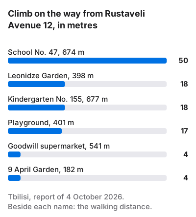
The climb shows most on the way to children's places. Kindergarten No. 155 is 677 metres away and 18 metres up. The nearest playground is 401 metres away and 17 metres up. Public School No. 47 is 674 metres away, and the way there gains 50 metres of height, like climbing to the sixteenth floor.
What the family profile changes
In the General profile the playground 401 metres away counts as 5.5 minutes, and 68% of its value remains. A playground counts in full only up to three minutes and is worth nothing by ten, so every minute here matters.
The family profile walks at 3.9 km/h rather than 4.8. The pace alone turns 401 metres into 6.2 minutes, and the playground's value falls to about 53%. Climbing also costs a family more: a factor of 5 instead of 3.5. So the real figure will be lower still. Stretches along traffic and waits at crossings cost more too, by 1.3 and 1.2 times.
There is good news as well. 9 April Garden is 182 metres away and only 4 metres up: three minutes on the flat. The Tbilisi Classical Gymnasium is 155 metres away, with a 3-metre climb. A couple of easy places right by the building matter more to a family than ten awkward ones.
Testing a neighbourhood with a pram: five lines of the report
- Stairs in the block "What can get in the way". Hundreds of metres mean that some short paths are closed to a pram.
- Crossings with a dropped kerb. If the map has almost none, walk the main route yourself before signing the contract.
- The climb to places in Education and children. More than 15–20 metres on the way to nursery or playground will be felt every day.
- Minutes spent climbing in the section on walking comfort. Compare them with the waits at crossings: whichever is larger is the neighbourhood's main problem.
- The score with the Family with a child profile. It recounts the minutes at a slower pace with costlier steps and makes a playground, a school and a park essential.
The map knows nothing about the lift in the building, the width of the pavement at your entrance or the cars parked on it. Those last metres can only be checked on foot. But the report tells you where to look first.
How the family profile recounts the minutes is described on How it is calculated. Other Tbilisi districts, including flatter ones, are on the Tbilisi page.
Questions
How can I tell whether a neighbourhood is pram-friendly?
Look in the report at the stairs on walking paths, the crossings with a dropped kerb and the climb on the way to nursery and playground. Then open the report with the family profile: it recounts the minutes at a slower pace.
Does the report account for stairs and underpasses?
Yes. Steps lengthen a route: one and a half times in the General profile, three times in the family profile. So with the family profile the route may go round a staircase.
Can I trust the kerb data?
Only as a pointer. Kerb and entrance tags exist for a small share of places on the map, so it is better to walk the main route yourself.
Which is harder with a pram: a slope or stairs?
Usually stairs: a slope can be taken slowly, while steps cannot be managed without help. In a report with the family profile both cost more than in the General profile.